|
|

|

SaVoir V4.3.1 (7/ 9 / 2010)
| New features | |
|---|---|
| 1 |
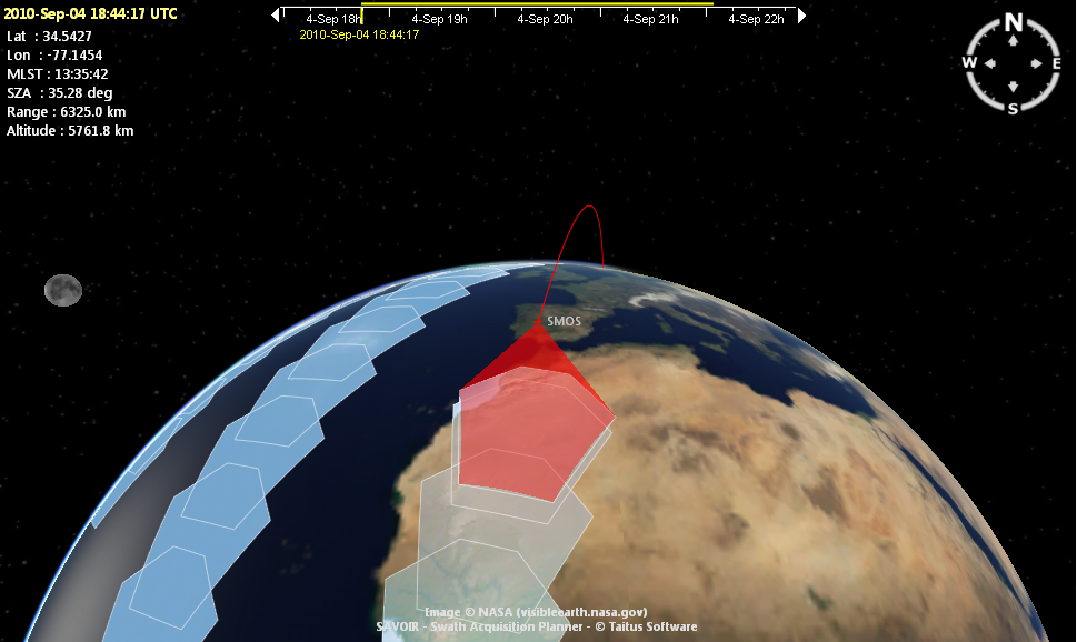
The Field of View of a sensor can be defined to operate as a Push broom (as it has always been in SaVoir) or as Polygonal data take. The new feature allows to define and display complex polygonal Field of View geometries. This is demonstrated in SMOS MIRAS instrument configuration. Currently the feature is limited to displaying data takes on the map. A Snapshot instrument is currently not processed by the swath intersection algorithm.
|
| 2 | The property grid for inspecting and editing the sensor swath coordinates has been enhanced to allow editing polygonal field of view sensors. |
| Fixed source | |
| 1 | Fixed exporting of swaths to GIS |
| 2 | Several fixes in the Dialog that allows inserting region coordinates from a character string. Before the string parser did not work correctly when inserting strings with double or triple space characters. If the string contains Tabs the parser does not retrieve correctly the coordinates. Now the user will get an error message. |
| Configuration updates | |
Multisatellite Swath Planner - © Taitus Software Italia srl All rights reserved- info: support@taitus.it