|
|

|

Welcome to SaVoir
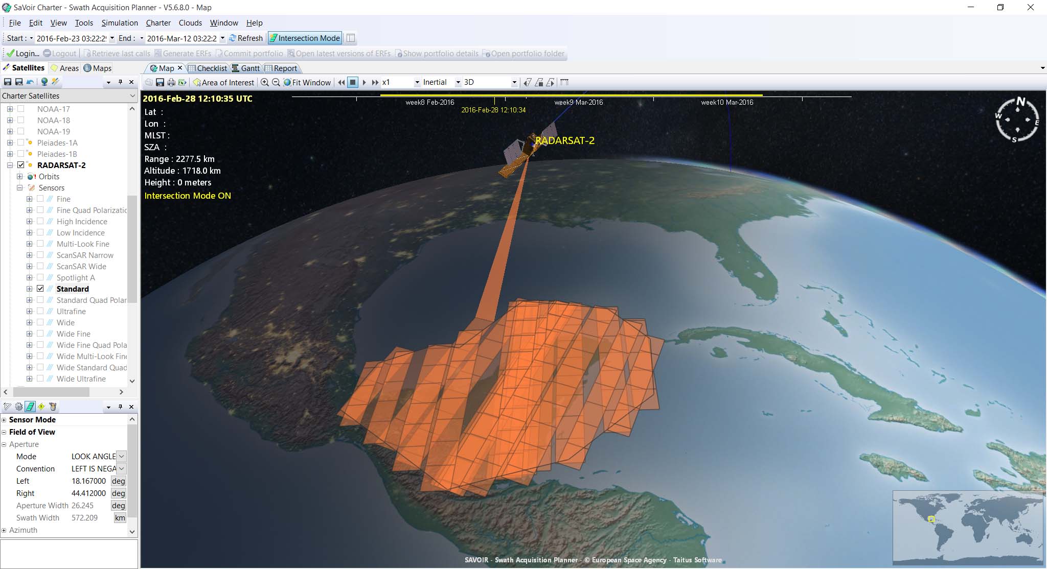
The Multisatellite Swath Planner(SaVoir ) is a Windows stand-alone application for analysing potential remote sensing opportunities from earth observation satellites.
By combining each satellite's orbit, sensor field of view geometry and the shape and location of a user-defined area of interest, SaVoir can determine the exact times when a satellite would be capable of observing the specified area.
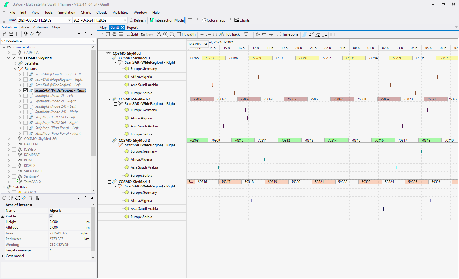
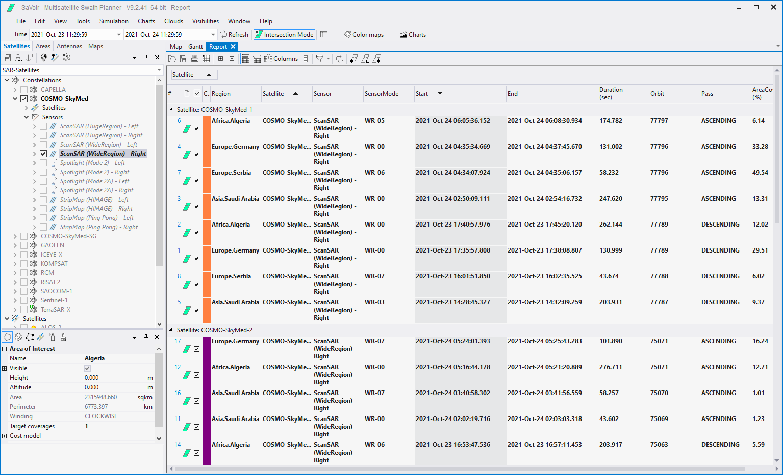
SaVoir will produce a suitable timeline of acquisitions based on the following inputs:
- Simulation time window
- One or more Satellites, Orbits and Sensors, selected from user-defined scenarios.
- One or more user-defined Areas of Interest

The output will presented simultaneously in an interactive 3D map display, a time chart (Gantt) and a report view. The result can be exported to external tools like Excel for external processing.

Multisatellite Swath Planner - © Taitus Software Italia srl All rights reserved- info: support@taitus.it