|
|

|

SaVoir V4.2.7 (27/05/2010)
| New features | |
|---|---|
| 1 |
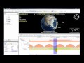
Analysis of Satellite to Satellite visibilities incorporates now plotting of Elevation angle profiles versus time. The Elevation angle is measured against the satellite body frame. This is useful to analyze for example the elevation angle of a DRS |
| Fixed source | |
| 1 | Threading model has been completely modified to improve application robustness and graphical 3D fluidity. |
| 2 | Fixed map tiles manager, which sometimes stopped downloading and rendered the map with the lowest resolution available. |
| 3 | Fixed cloud map ignored when Show Clouds option was selected. |
| 4 | Fixed crash when displaying several 3D models in augmented scale and changing the map background. |
| 5 | Fixed Cycle number and Relative Orbit Number calculation on some cases of ROEF |
| Configuration updates | |
Multisatellite Swath Planner - © Taitus Software Italia srl All rights reserved- info: support@taitus.it