|
|

|

Albedo
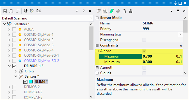
Define minimum and maximum avg Albedo (0..1).
If the estimation for a swath is outside the defined boundaries the swath will be discarded
Albedo estimation are available in SaVoir via monthly statistical maps with avg, min, max, and stddev
Albedo is an estimation of the surface reflectivity, in the range [0..1], with 0 representing total absorption and 1 total reflection.
Albedo estimations are available only for land. SaVoir will disregard albedo estimations for marine areas by returning a value of-1, negative, meaning invalid.
Multisatellite Swath Planner - © Taitus Software Italia srl All rights reserved- info: support@taitus.it