|
|

|

Steerable sensors and best fit
Some satellites have steerable sensors. This allows revisiting of the same area by steering the sensor in different directions (off-nadir) during subsequent satellite passes. SaVoir can obtain the off-nadir angle required in order to sense a particular area. Positive values are for angles left of nadir and negative values are for right of nadir. SaVoir offers a best fit, or maximum coverage of the area of interest for the sensor and the possibility to shift across track the sensor to cover a particular area.
An example of using steerable sensors:
- Select the area of interest.
- Select the satellite and steerable sensor (e.g. CosmoSkymed, ScanSAR (Wide Region) Right).
- Select the scenario start and end dates (e.g. 23/01/2006 18:48:37 to 24/01/2006 18:48:37).
- The resulting swath is shown (see Diagram 1).
- Right click on the swath and choose Edit / Find Best Fit in order to find the off-nadir angle (see Diagram 1) that best covers the area of interest.
- Once a best fit has been established right click on the resulting best fit swath and choose Edit / Shift Across-Track to manually steer the sensor. Moving the cursor left and right will steer the sensor in the same direction. Select the desired swath by clicking on the left button (see Diagram 2).
- The sensor can also be steered to a specific angle or beam by right clicking the swath and selecting Edit / Set Across-Track Angle ... or Edit / Specify ...
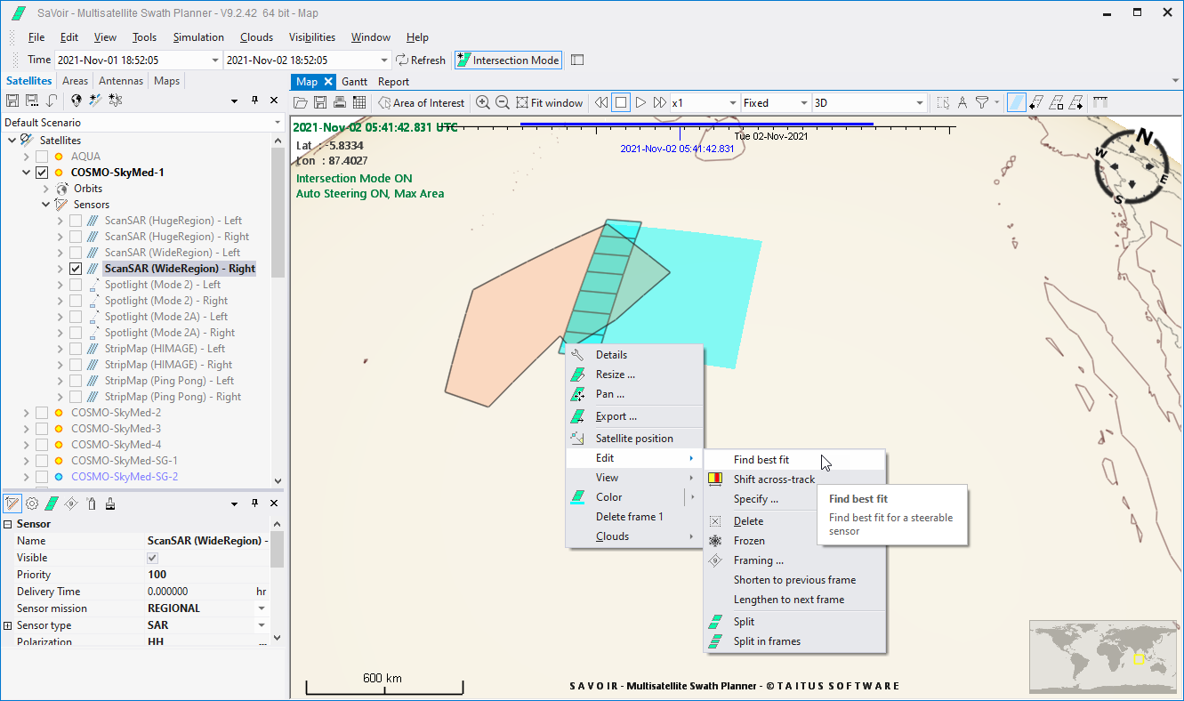
Diagram 1. Example showing CosmoSkymed ScanSAR field of regard (the highlighted area either side of the ground track) and best fit (rightmost highlighted area of the swath).
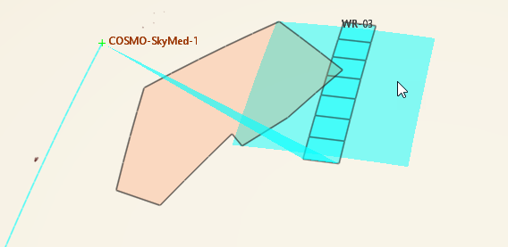
Diagram 2. The shifted off-nadir mode is modified in the satellite sensor mode list.
See also: Select satellites and sensors Basic concepts
Multisatellite Swath Planner - © Taitus Software Italia srl All rights reserved- info: support@taitus.it