|
|

|

SaVoir V5.1.0
| New features | |
|---|---|
| 1 |
New feature to handle restricted Areas of Interest. |
| 2 |
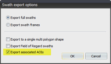
New feature allows to export associated Areas of Interest when exporting swaths as shape files.
|
| 3 |
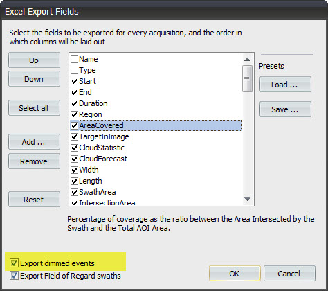
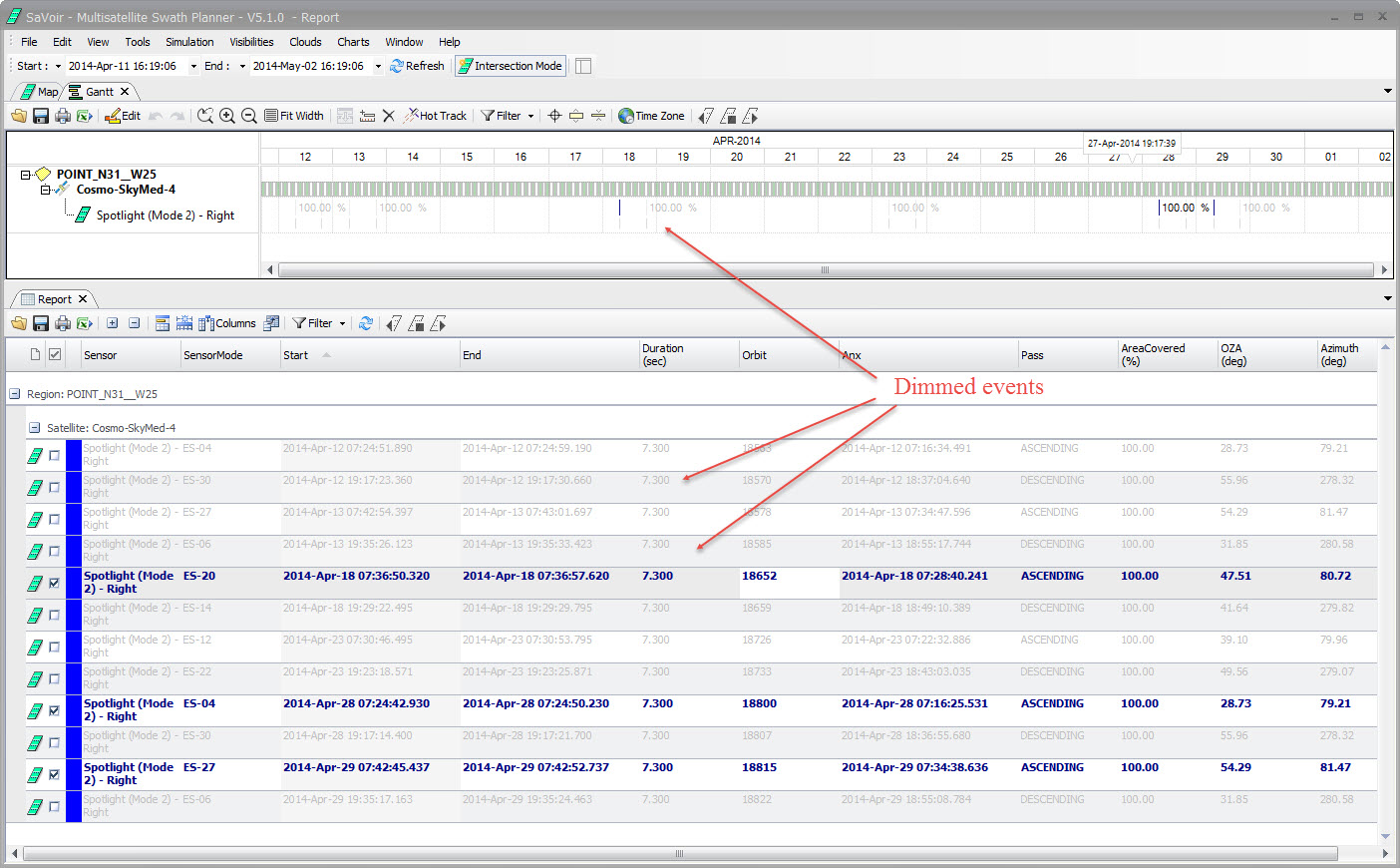
New feature allows to decide whether exporting or not dimmed events on Excel. Dimmed events are events partially visible on Gantt, Reports or Maps, as a result of "Highlight this only", "Highlight overlapping swaths", or simply event selection on the Report view.
|
| Fixed source | |
| 1 |
Fixed workspace to correctly load stencil properties. |
| 2 |
Fix in generation of bounding box of point regions. SaVoir will create a bounding box of 1km x 1km |
| 3 |
Fix in excel output. SaVoir generated duplicated columns. |
| 4 |
Fix in KML file ingestion to avoid crash:
|
| 5 |
Outer border is now enabled by default |
| 6 |
Fixes editing of circle radius, latitude and longitude values in properties pane. Before the editing was not implemented. |
| 7 |
Fixed display of tree icons on high DPI screens. |
| 8 |
Fixed Area of Interest Wizard to allow for safe area editing. Before, changing the area name through the wizard created several data inconsistencies leading to crash. |
| 9 |
Fixed clouds forecast error in file naming which could lead to crash during cloud forecast data download. |
| 10 |
Improved handling of large Areas of Interest(> 5000 points). This fix affects only visualization. - the filling algorithm turns to "planar", not spherical improving the performance and avoiding crash if triangulation fails, at the expense of loss of sphericity in 3D projections. This is not a problem if the AOI radius is small (< 120 km). - If it can't build a proper triangulation, filling will not be done. |
| Configuration updates | |
| 1 | Added ISS-URTHECAST |
| 2 |
Added Sentinel-1A after its recent launch |
| 3 | Small correction to Sentinel-1 roll steering coefficients (6th polynomial element was missing) |
| 4 | Corrected TerraSAR-X and TanDEM-X Spotlight mode (SL) scene dimensions to fixed 10 x 10 km |
Multisatellite Swath Planner - © Taitus Software Italia srl All rights reserved- info: support@taitus.it